Global identification of levees and their heights for flood inundation mapping
This is a digital version of the AGU23 poster H31Z-1861.
Why
While levees are important assets in natural hazard risk assessments, accurate information in the public domain about the location and height of these embankments is often missing. Whereas Nienhuis et al. (2022) made an inventory of levees based on public information, van Nieuwenhuizen et al. (2021), Knox et al. (2022), and Wing et al. (2019) find levees based on a per pixel basis. We aim to improve upon inventories based on public information that are inherently incomplete and per pixel methods that are prone to result in line segments with gaps.
How
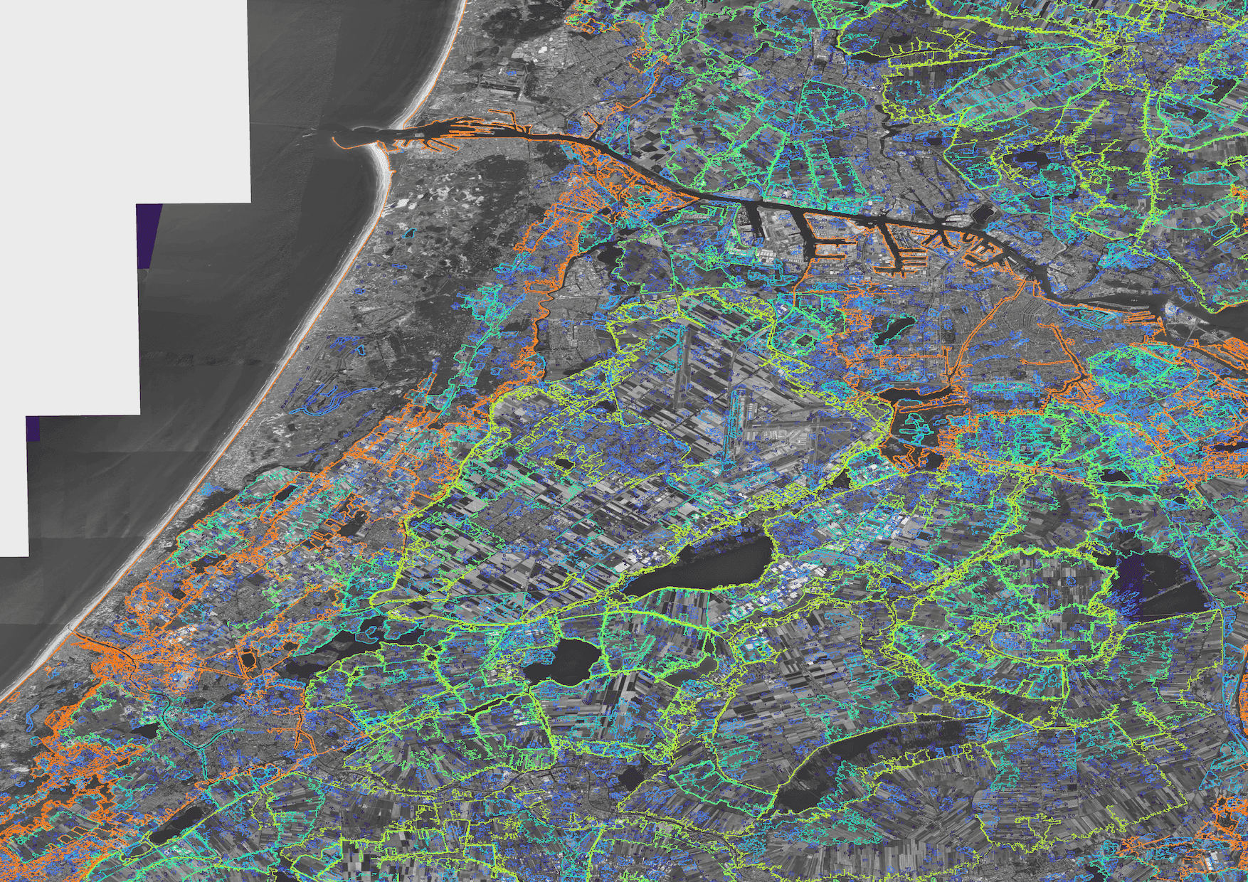
We build upon Wood et al. (2018), who used radar-based flood maps, together with gauge information to detect embankments. Here we create artificial extents by flooding a DEM for a range of elevations and take the outline of the flooded areas each time. When the outlines of two flooded areas meet, we save the line. By taking the volume and perimeter, we can find actual levees, filtering out the edges smaller ponds or larger valleys.

Discussion
While this method scales globally, as it only requires an elevation model, and produces closed (watertight) line segments, it also produces a large number of false positives.
- These include the edges of smaller features, such as ponds and dune slacks.
- Similarly, the edges of larger depressions, such as valleys and canyons are also included.
- Lastly, in digital surface models, such as global elevation models, further work is needed to remove false positives from forest edges.


References
Knox, R. L., R. R. Morrison, and E. E. Wohl. 2022. “Identification of Artificial Levees in the Contiguous United States.” Water Resources Research 58 (4): e2021WR031308. https://doi.org/10.1029/2021WR031308.
Nienhuis, Jaap H., Jana R. Cox, Joey O’Dell, Douglas A. Edmonds, and Paolo Scussolini. 2022. “A Global Open-Source Database of Flood-Protection Levees on River Deltas (openDELvE).” Natural Hazards and Earth System Sciences 22 (12): 4087–4101. https://doi.org/10.5194/nhess-22-4087-2022.
Van Nieuwenhuizen, Nigel, John B. Lindsay, and Ben DeVries. 2021. “Automated Mapping of Transportation Embankments in Fine-Resolution LiDAR DEMs.” Remote Sensing 13 (7): 1308. https://doi.org/10.3390/rs13071308.
Wing, Oliver E. J., Paul D. Bates, Jeffrey C. Neal, Christopher C. Sampson, Andrew M. Smith, Niall Quinn, Iuliia Shustikova, et al. 2019. “A New Automated Method for Improved Flood Defense Representation in Large-Scale Hydraulic Models.” Water Resources Research 55 (12): 11007–34. https://doi.org/10.1029/2019WR025957.
Wood, Melissa, Steven De Jong, and M.W. Straatsma. 2018. “Locating Flood Embankments Using SAR Time Series: A Proof of Concept.” International Journal of Applied Earth Observation and Geoinformation 70 (May): 72–83. https://doi.org/10.1016/j.jag.2018.04.003.
Links
You can download the poster here and cite it as:
Pronk, Maarten, and Matthijs Gawehn (2023), “Global Identification of Levees and Their Heights for Flood Inundation Mapping.” (H31Z-1861) presented at AGU23, 11-15 Dec. https://agu.confex.com/agu/fm23/meetingapp.cgi/Paper/1310826.